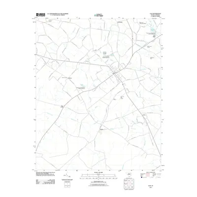
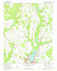
2011 Map of Clio
USGS Topo · Published 2011About this map
Clio serves as the central hub for this rural Marlboro County landscape, where agriculture and small-town settlement intersect. The town center is anchored by the Clio Post Office, while the surrounding countryside is dotted with established community landmarks like Hebron, Dunbar, and Five Forks. Notable for genealogists, the map identifies several local burial grounds including Quick Cemetery, Hebron Cemetery, Lucas Cemetery, and Ebenezer Cemetery, providing specific points of interest for family history research.
Find a feature on this map
98 named features on this map. Tap any name to fly to it.
Don’t see what you’re looking for? This feature index may not catch every label — zoom into the map to look around manually.
Map Details
Editions of this 2011 Clio Map
This is the sole edition of this map. No revisions or reprints were ever made.
Other maps of this area
1942 · Rockingham
USGS Topo · 1:125,000
1943 · Gum Swamp
USGS Topo · 1:62,500

1953 · Florence
USGS Topo · 1:250,000

1954 · Florence
USGS Topo · 1:250,000
1960 · Dillon West
USGS Topo · 1:24,000
1971 · Minturn
USGS Topo · 1:24,000
1971 · Johns
USGS Topo · 1:24,000
1972 · Drake
USGS Topo · 1:24,000
1972 · Clio
USGS Topo · 1:24,000
1972 · Bennettsville North
USGS Topo · 1:24,000