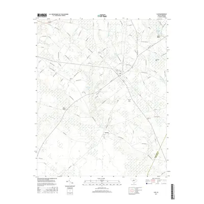
2017 Map of Clio
USGS Topo · Published 2017About this map
The town of Clio serves as the central hub for this corner of Marlboro County, situated within a landscape defined by an intricate network of Carolina bays and swampy prongs. These distinctive elliptical depressions, such as McLaurin Bay and Burnt Bay, shape the local drainage patterns and road layouts, often flanking the agricultural fields that dominate the region. To the east, the settlement of Red Bluff sits near the shores of Red Bluff Lake, while the smaller community of Dunbar and the crossroads at Five Forks anchor the southern and western portions of the quadrangle. For those researching local lineages, the map identifies several rural burial sites, including Quick Cemetery, Hebron Cemetery, and Ebenezer Cemetery. The agricultural economy is further evidenced by the Clio Crop Care Airport, reflecting the ongoing importance of crop dusting in the South Carolina Coastal Plain.
Find a feature on this map
99 named features on this map. Tap any name to fly to it.
Don’t see what you’re looking for? This feature index may not catch every label — zoom into the map to look around manually.
Map Details
Editions of this 2017 Clio Map
This is the sole edition of this map. No revisions or reprints were ever made.
Other maps of this area

1942 · Rockingham
USGS Topo · 1:125,000

1943 · Gum Swamp
USGS Topo · 1:62,500

1953 · Florence
USGS Topo · 1:250,000

1954 · Florence
USGS Topo · 1:250,000

1960 · Dillon West
USGS Topo · 1:24,000

1971 · Minturn
USGS Topo · 1:24,000

1971 · Johns
USGS Topo · 1:24,000

1972 · Drake
USGS Topo · 1:24,000

1972 · Clio
USGS Topo · 1:24,000
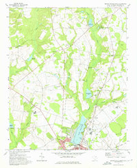
1972 · Bennettsville North
USGS Topo · 1:24,000