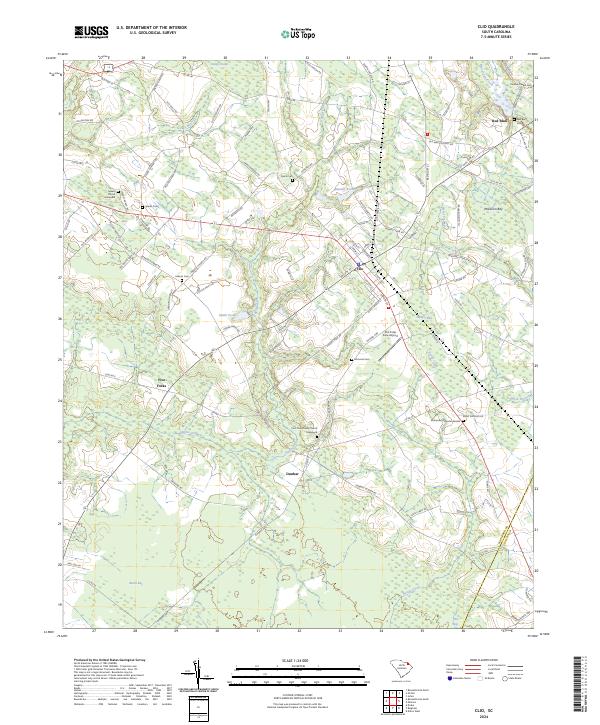
2024 Map of Clio
USGS Topo · Published 2024About this map
Clio serves as the focal point of this Marlboro County landscape, where the intersection of traditional agricultural roots and modern aviation is visible at the Clio Crop Care Airport. The surrounding terrain is defined by a complex network of wetlands and named bays, including McLaurin Bay and Juniper Bay, which suggest the unique Carolina Bay geological formations common to this region. These depressions, along with watercourses like Reedy Creek and Hagins Prong, have historically dictated the placement of homesteads and connecting roads such as Old Hwy 15 and Red Bluff Rd.
Find a feature on this map
110 named features on this map. Tap any name to fly to it.
Don’t see what you’re looking for? This feature index may not catch every label — zoom into the map to look around manually.
Map Details
Editions of this 2024 Clio Map
This is the sole edition of this map. No revisions or reprints were ever made.
Other maps of this area

1942 · Rockingham
USGS Topo · 1:125,000

1943 · Gum Swamp
USGS Topo · 1:62,500

1953 · Florence
USGS Topo · 1:250,000

1954 · Florence
USGS Topo · 1:250,000

1960 · Dillon West
USGS Topo · 1:24,000

1971 · Minturn
USGS Topo · 1:24,000

1971 · Johns
USGS Topo · 1:24,000

1972 · Drake
USGS Topo · 1:24,000

1972 · Clio
USGS Topo · 1:24,000
1972 · Bennettsville North
USGS Topo · 1:24,000