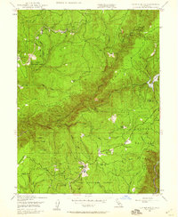
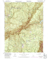
1948 Map of Clipper Mills
USGS Topo · Published 1959About this map
Clipper Mills and the surrounding timber and mining country of the northern Sierras appear here in the late 1940s. Situated along the boundary of Butte Co Yuba Co, this landscape is defined by its deep canyons and resource extraction, notably the Triumph Mine and the Monte de Oro Mine. The community at Woodleaf and the local Clipper Mills School serve as central points for a population dispersed among isolated outposts like Maynards Ranch and Bean Ranch.
Find a feature on this map
54 named features on this map. Tap any name to fly to it.
Don’t see what you’re looking for? This feature index may not catch every label — zoom into the map to look around manually.
Map Details
Editions of this 1948 Clipper Mills Map
5 editions found
Other maps of this area

1888 · Smartsville
USGS Topo · 1:125,000

1888 · Bidwell Bar
USGS Topo · 1:125,000

1891 · Bidwell Bar
USGS Topo · 1:125,000

1891 · Smartsville
USGS Topo · 1:125,000

1892 · Smartsville
USGS Topo · 1:125,000

1893 · Bidwell Bar
USGS Topo · 1:125,000

1894 · Smartsville
USGS Topo · 1:125,000

1895 · Bidwell Bar
USGS Topo · 1:125,000

1895 · Smartsville
USGS Topo · 1:125,000

1897 · Bidwell Bar
USGS Topo · 1:125,000