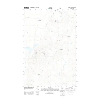
2013 Map of Cloquet Lake
USGS Topo · Published 2013About this map
Superior National Forest encompasses this stretch of the Minnesota North Shore highlands, where a dense network of glacial lakes and creek drainages defines the landscape. The Cloquet Lookout Tower stands as a prominent man-made landmark near Cloquet Lake and Sink Lake, markers of the region's long history with forest management and fire observation. Transportation in this era is largely confined to forest routes such as Whyte Rd and Cloquet Lake Rd, which provide access to remote water bodies like Katherine Lake and Drake Lake. The drainage patterns are complex, with the East Branch Beaver River and various tributaries like Hen Cr and Big Thirtynine Cr winding through the timbered terrain, reflecting the hydrologic character of the Lake Superior watershed.
Find a feature on this map
23 named features on this map. Tap any name to fly to it.
Don’t see what you’re looking for? This feature index may not catch every label — zoom into the map to look around manually.
Map Details
Editions of this 2013 Cloquet Lake Map
This is the sole edition of this map. No revisions or reprints were ever made.
Other maps of this area

1953 · Whyte
USGS Topo · 1:62,500

1954 · Greenwood Lake
USGS Topo · 1:62,500

1954 · Silver Bay
USGS Topo · 1:62,500

1954 · Two Harbors
USGS Topo · 1:250,000

1955 · Isabella
USGS Topo · 1:62,500

1957 · Two Harbors
USGS Topo · 1:250,000

1958 · Two Harbors
USGS Topo · 1:250,000

1964 · Two Harbors
USGS Topo · 1:250,000

1976 · Two Harbors
USGS Topo · 1:100,000
1981 · Legler Lake
USGS Topo · 1:24,000
Featured Places
- Silver Creek Township, MN
- Beaver Bay Township, MN
- Stony River Township, MN
- Lake County, MN
- United States