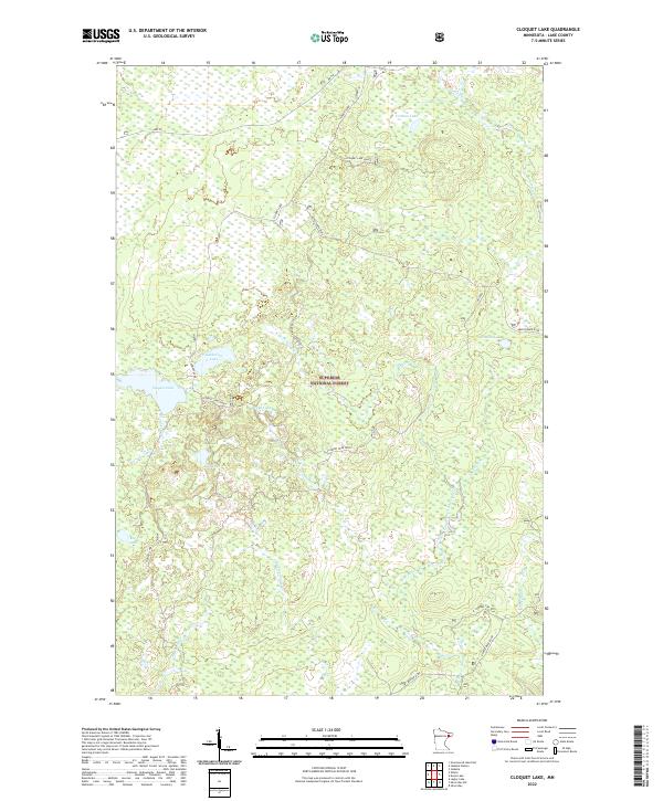
2022 Map of Cloquet Lake
USGS Topo · Published 2022About this map
The Superior National Forest in Lake County contains a complex network of glacial lakes and headwater streams within this recent topographic study. The landscape is defined by the drainage systems of the Cloquet River and the Beaver River, which carve through the wooded terrain of northeastern Minnesota. Prominent water bodies such as Cloquet Lake, Ekbeck Lake, and Ferman Lake are interspersed with smaller features like Katherine Lake and Drake Lake.
Find a feature on this map
29 named features on this map. Tap any name to fly to it.
Don’t see what you’re looking for? This feature index may not catch every label — zoom into the map to look around manually.
Map Details
Editions of this 2022 Cloquet Lake Map
This is the sole edition of this map. No revisions or reprints were ever made.
Other maps of this area

1953 · Whyte
USGS Topo · 1:62,500

1954 · Greenwood Lake
USGS Topo · 1:62,500

1954 · Silver Bay
USGS Topo · 1:62,500

1954 · Two Harbors
USGS Topo · 1:250,000

1955 · Isabella
USGS Topo · 1:62,500

1957 · Two Harbors
USGS Topo · 1:250,000

1958 · Two Harbors
USGS Topo · 1:250,000

1964 · Two Harbors
USGS Topo · 1:250,000

1976 · Two Harbors
USGS Topo · 1:100,000
1981 · Legler Lake
USGS Topo · 1:24,000
Featured Places
- Silver Creek Township, MN
- Stony River Township, MN
- Beaver Bay Township, MN
- Lake County, MN
- United States