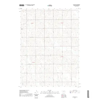
2017 Map of Closter SW
USGS Topo · Published 2017About this map
O'Neil Valley sits at the northwestern edge of this landscape, marking a localized settlement point within the high plains of Boone County. The area is defined by the winding course of Shell Cr, which cuts diagonally across the center of the terrain, eventually joined by tributaries such as N Shell Cr and Vorhees Cr. The map reveals a strictly regulated section-line road grid, characterized by routes like 180th Ave and 200th St, which facilitate access across the agricultural parcels. A notable aspect of the infrastructure is the designated Minimum Maintenance Rd, indicating segments of the rural network that remain less developed or seasonally restricted. This 2017 survey reflects the persistent pattern of large-scale farming and drainage management in Nebraska's interior, where the relationship between the prairie creeks and the township-range grid remains the dominant organizing force.
Find a feature on this map
18 named features on this map. Tap any name to fly to it.
Don’t see what you’re looking for? This feature index may not catch every label — zoom into the map to look around manually.
Map Details
Editions of this 2017 Closter SW Map
This is the sole edition of this map. No revisions or reprints were ever made.
Other maps of this area

1954 · Albion West
USGS Topo · 1:24,000

1955 · Broken Bow
USGS Topo · 1:250,000

1955 · Fremont
USGS Topo · 1:250,000

1956 · Broken Bow
USGS Topo · 1:250,000

1957 · Fremont
USGS Topo · 1:250,000

1958 · Fremont
USGS Topo · 1:250,000

1958 · Albion East
USGS Topo · 1:24,000

1963 · Petersburg
USGS Topo · 1:24,000

1963 · Closter SW
USGS Topo · 1:24,000

1963 · Closter SE
USGS Topo · 1:24,000