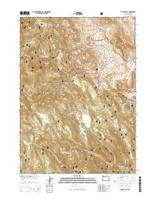
2014 Map of Clover Flat
USGS Topo · Published 2014About this map
Fremont National Forest dominates this section of south-central Oregon, where high-altitude plateaus and drainage basins define the geography. The terrain is characterized by broad, elevated openings like Clover Flat and Paxton Meadows, which are interspersed between heavily forested ridges. Water management is evident through the presence of O'Leary Reservoir and Red Knoll Reservoir in the northern portion of the sheet, while numerous springs such as Buck Spring, Moss Flat Spring, and Pine Spring serve as critical water sources in an otherwise arid environment. A complex network of timber and access roads, including Clover Flat Rd and various National Forest Development Roads, crisscrosses the landscape. These routes connect isolated landmarks like Moss Pass and Bear Flat, illustrating the administrative and recreational infrastructure within the national forest system during the early 21st century.
Find a feature on this map
36 named features on this map. Tap any name to fly to it.
Don’t see what you’re looking for? This feature index may not catch every label — zoom into the map to look around manually.
Map Details
Editions of this 2014 Clover Flat Map
This is the sole edition of this map. No revisions or reprints were ever made.
Other maps of this area

1955 · Klamath Falls
USGS Topo · 1:250,000

1958 · Klamath Falls
USGS Topo · 1:250,000

1964 · Crooked Creek Valley
USGS Topo · 1:24,000

1964 · Valley Falls
USGS Topo · 1:24,000

1964 · Cox Flat
USGS Topo · 1:24,000

1964 · Shoestring Butte
USGS Topo · 1:24,000

1964 · Clover Flat
USGS Topo · 1:24,000

1964 · Big Baldy
USGS Topo · 1:24,000

1966 · Morgan Butte
USGS Topo · 1:24,000

1966 · Tucker Hill
USGS Topo · 1:24,000