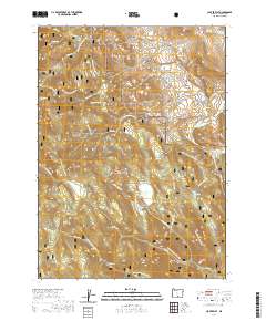
2020 Map of Clover Flat
USGS Topo · Published 2020About this map
Fremont National Forest dominates this section of Lake County, Oregon, revealing a landscape defined by timber management and high-desert drainage. The area is marked by a network of forest development roads and the Southern Oregon Intertie Trail, which crosses through varying elevations near Mass Pass. Notable water features include the O'Leary Reservoir and Red Knoll Reservoir in the northern reaches, while the interior is dotted with high meadows and flats such as Bear Flat, Moss Flat, and Paxton Meadows. This 2020 survey illustrates how the natural topography dictates the movement of water through systems like Moss Cr and Mill Flat Cr, which eventually feed into the N Fork Cox Cr. The map provides a clear look at the boundaries of several townships and ranges, including t36s r19e and t36s r20e, showing the intersection of public land management and natural geography.
Find a feature on this map
44 named features on this map. Tap any name to fly to it.
Don’t see what you’re looking for? This feature index may not catch every label — zoom into the map to look around manually.
Map Details
Editions of this 2020 Clover Flat Map
This is the sole edition of this map. No revisions or reprints were ever made.
Other maps of this area

1955 · Klamath Falls
USGS Topo · 1:250,000

1958 · Klamath Falls
USGS Topo · 1:250,000

1964 · Crooked Creek Valley
USGS Topo · 1:24,000

1964 · Valley Falls
USGS Topo · 1:24,000

1964 · Cox Flat
USGS Topo · 1:24,000

1964 · Shoestring Butte
USGS Topo · 1:24,000

1964 · Clover Flat
USGS Topo · 1:24,000

1964 · Big Baldy
USGS Topo · 1:24,000

1966 · Morgan Butte
USGS Topo · 1:24,000

1966 · Tucker Hill
USGS Topo · 1:24,000