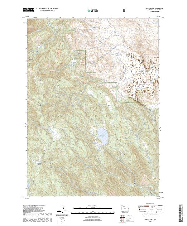
2023 Map of Clover Flat
USGS Topo · Published 2023About this map
Fremont National Forest dominates this high-altitude landscape in Lake County, characterized by a series of open meadows and upland flats. The topography is defined by significant landmarks such as Clover Flat and Moss Flat, which serve as natural catchment areas for the local drainage system. Water management in this semi-arid region is evident through the presence of O'Leary Reservoir and Red Knoll Reservoir in the northeast. The map traces a network of backcountry routes, including the Southern Oregon Intertie Trl and various motorized forest trails that navigate through Moss Pass and past Paxton Meadows. This complex of meadows and creeks, including the headwaters of North Fork Cox Creek and East Camp Creek, illustrates the essential relationship between the seasonal water supply and the forest's high-country terrain.
Find a feature on this map
40 named features on this map. Tap any name to fly to it.
Don’t see what you’re looking for? This feature index may not catch every label — zoom into the map to look around manually.
Map Details
Editions of this 2023 Clover Flat Map
This is the sole edition of this map. No revisions or reprints were ever made.
Other maps of this area

1955 · Klamath Falls
USGS Topo · 1:250,000

1958 · Klamath Falls
USGS Topo · 1:250,000

1964 · Crooked Creek Valley
USGS Topo · 1:24,000

1964 · Valley Falls
USGS Topo · 1:24,000

1964 · Cox Flat
USGS Topo · 1:24,000

1964 · Shoestring Butte
USGS Topo · 1:24,000

1964 · Clover Flat
USGS Topo · 1:24,000

1964 · Big Baldy
USGS Topo · 1:24,000

1966 · Morgan Butte
USGS Topo · 1:24,000

1966 · Tucker Hill
USGS Topo · 1:24,000