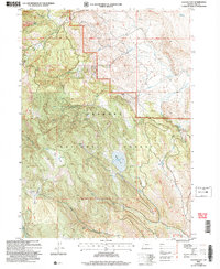
2004 Map of Clover Flat
USGS Topo · Published 2007About this map
Counts Ranch sits near the heart of this landscape in the Fremont National Forest, representing the ranching history of Lake County. This 2004 revision, based on earlier topographic data, illustrates the high-desert and mountainous character of southeastern Oregon, where water sources like Buck Spring, Fir Spring, and the O'Leary Reservoir are critical landmarks. The drainage network is well-defined by Cox Creek, Pine Creek, and Willow Creek, which feed into various flats such as Bear Flat and Moss Flat.
Find a feature on this map
31 named features on this map. Tap any name to fly to it.
Don’t see what you’re looking for? This feature index may not catch every label — zoom into the map to look around manually.
Map Details
Editions of this 2004 Clover Flat Map
This is the sole edition of this map. No revisions or reprints were ever made.
Other maps of this area

1955 · Klamath Falls
USGS Topo · 1:250,000

1958 · Klamath Falls
USGS Topo · 1:250,000

1964 · Crooked Creek Valley
USGS Topo · 1:24,000

1964 · Valley Falls
USGS Topo · 1:24,000

1964 · Cox Flat
USGS Topo · 1:24,000

1964 · Shoestring Butte
USGS Topo · 1:24,000

1964 · Clover Flat
USGS Topo · 1:24,000

1964 · Big Baldy
USGS Topo · 1:24,000

1966 · Morgan Butte
USGS Topo · 1:24,000

1966 · Tucker Hill
USGS Topo · 1:24,000