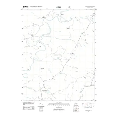
2011 Map of Clover Lick
USGS Topo · Published 2011About this map
The Greenbrier River meanders through this portion of Pocahontas County, defining a landscape of hollows and ridges where small settlements like Clover Lick and Stony Bottom have long persisted. In the eastern reaches, the Dunmore Post Office serves the community of Dunmore, while to the south, Dilleys Mill sits near the confluence of Thorny Creek and Marlin Lick Run. The map provides significant detail for local historians, marking the Bethel Church and its adjacent Bethel Cemetery, as well as the Buckskin Reservation Boy Scout Camp tucked near Lake Sam Hill. High points such as Thomas Mountain and Thorny Mountain, the latter featuring the Thorny Mountain Lookout Tower, offer a look at the topography that has shaped movement and industry in the region. Other notable landmarks include the Seven Mile Campground and the small settlement of Frost at the southeastern edge of the survey.
Find a feature on this map
60 named features on this map. Tap any name to fly to it.
Don’t see what you’re looking for? This feature index may not catch every label — zoom into the map to look around manually.
Map Details
Editions of this 2011 Clover Lick Map
This is the sole edition of this map. No revisions or reprints were ever made.
Other maps of this area

1891 · Huntersville
USGS Topo · 1:125,000

1894 · Huntersville
USGS Topo · 1:125,000

1901 · Monterey
USGS Topo · 1:125,000

1922 · Cass
USGS Topo · 1:48,000

1923 · Marlinton
USGS Topo · 1:48,000

1923 · Warm Springs
USGS Topo · 1:48,000

1923 · Mingo
USGS Topo · 1:48,000

1924 · Cass
USGS Topo · 1:62,500

1925 · Mingo
USGS Topo · 1:62,500

1925 · Marlinton
USGS Topo · 1:62,500