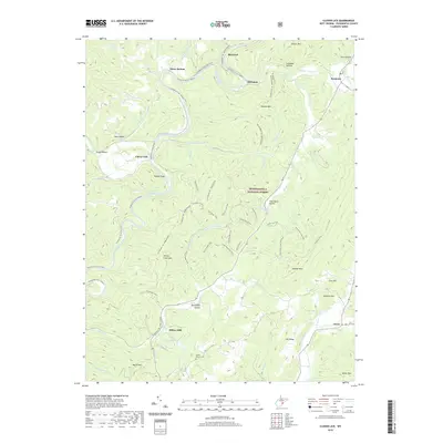
2019 Map of Clover Lick
USGS Topo · Published 2019About this map
The Greenbrier River meanders through the heart of the Monongahela National Forest, carving a deep valley through the Allegheny Mountains of Pocahontas County. Along its banks, the Greenbrier River Rail Trail follows a historic transport corridor that once connected timber and tannery operations. This 2019 survey captures a landscape defined by small valley settlements like Stony Bottom, Sitlington, and Dunmore, where geography dictates the layout of local life. To the south, Dilleys Mill and Frost anchor the agricultural and residential pockets near the base of Michael Mountain. The rugged terrain is etched with numerous family-named hollows and peaks, including Rabbit Knob and Marlin Mountain. For genealogists and local historians, the presence of Bethel Church (Cem) and the intricate network of forest paths like the Allegheny Trail offer specific points of interest for tracing community development in this high-altitude region.
Find a feature on this map
62 named features on this map. Tap any name to fly to it.
Don’t see what you’re looking for? This feature index may not catch every label — zoom into the map to look around manually.
Map Details
Editions of this 2019 Clover Lick Map
This is the sole edition of this map. No revisions or reprints were ever made.
Other maps of this area

1891 · Huntersville
USGS Topo · 1:125,000

1894 · Huntersville
USGS Topo · 1:125,000

1901 · Monterey
USGS Topo · 1:125,000

1922 · Cass
USGS Topo · 1:48,000

1923 · Marlinton
USGS Topo · 1:48,000

1923 · Warm Springs
USGS Topo · 1:48,000

1923 · Mingo
USGS Topo · 1:48,000

1924 · Cass
USGS Topo · 1:62,500

1925 · Mingo
USGS Topo · 1:62,500

1925 · Marlinton
USGS Topo · 1:62,500