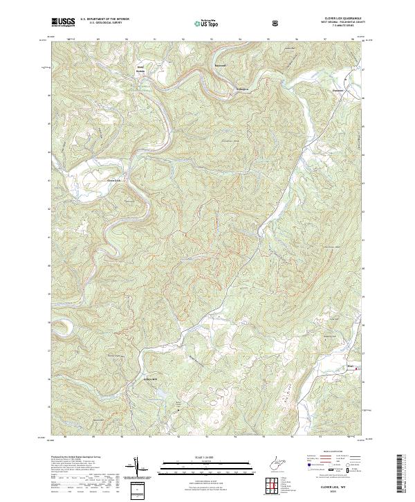
2023 Map of Clover Lick
USGS Topo · Published 2023About this map
The Greenbrier River carves a deep valley through this portion of the Monongahela National Forest, defining the settlement patterns of Pocahontas County. Along its banks, the Greenbrier River Rail-Trl traces the path of former industrial transport, connecting locales like Clover Lick and Stony Bottom. To the south, the landscape shifts toward the high ridges of Marlin Mtn and Thorny Creek Mtn, where smaller communities like Dilleys Mill are situated near water sources like Thorny Creek.
Find a feature on this map
58 named features on this map. Tap any name to fly to it.
Don’t see what you’re looking for? This feature index may not catch every label — zoom into the map to look around manually.
Map Details
Editions of this 2023 Clover Lick Map
This is the sole edition of this map. No revisions or reprints were ever made.
Other maps of this area

1891 · Huntersville
USGS Topo · 1:125,000

1894 · Huntersville
USGS Topo · 1:125,000

1901 · Monterey
USGS Topo · 1:125,000

1922 · Cass
USGS Topo · 1:48,000

1923 · Marlinton
USGS Topo · 1:48,000

1923 · Warm Springs
USGS Topo · 1:48,000

1923 · Mingo
USGS Topo · 1:48,000

1924 · Cass
USGS Topo · 1:62,500

1925 · Mingo
USGS Topo · 1:62,500

1925 · Marlinton
USGS Topo · 1:62,500