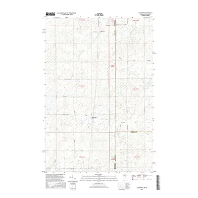
2016 Map of Cloverton
USGS Topo · Published 2016About this map
Cloverton and Kingsdale anchor this northern borderland landscape along the Minnesota-Wisconsin state line. The terrain is defined by a dense network of forest and marshland, where the headwaters of regional streams weave through low-lying sections. This 2016 survey documents the rural character of the region, showing how section roads and rural routes connect isolated settlements across the state border. The placement of Kingsdale in the northern reach and Cloverton further south illustrates the sparse, grid-dependent development typical of this timber and wetland country. This map offers a clear view of the modern infrastructure and drainage patterns that continue to shape local land use in Pine, Douglas, and Burnett counties.
Find a feature on this map
2 named features on this map. Tap any name to fly to it.
Don’t see what you’re looking for? This feature index may not catch every label — zoom into the map to look around manually.
Map Details
Editions of this 2016 Cloverton Map
This is the sole edition of this map. No revisions or reprints were ever made.
Other maps of this area

1949 · Danbury
USGS Topo · 1:48,000

1949 · Holyoke
USGS Topo · 1:48,000

1949 · Webb Lake
USGS Topo · 1:48,000

1949 · Patzau
USGS Topo · 1:48,000

1953 · Duluth
USGS Topo · 1:250,000

1955 · Webb Lake
USGS Topo · 1:62,500

1955 · Patzau
USGS Topo · 1:62,500

1958 · Duluth
USGS Topo · 1:250,000

1962 · Holyoke
USGS Topo · 1:62,500

1962 · Danbury
USGS Topo · 1:62,500