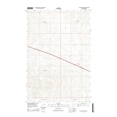
2014 Map of Cluster Buttes SW
USGS Topo · Published 2014About this map
Krug Cr winds through the heart of this Dawson County landscape, illustrating the drainage patterns that define this section of eastern Montana. The map highlights a rural region dominated by large-scale land divisions and a network of secondary roads, with Interstate 94 cutting a diagonal path across the terrain. This transportation artery connects the area to the wider region, while smaller routes like Road 330 and Cr-106 provide access to the hinterlands. In the north, Griffith Cr flows through the upper townships, and to the south, the headwaters of Hodges Cr emerge. The landscape is characterized by its creek beds and the surveyed grid of the Public Land Survey System, which organizes the territory into townships such as t15n r58e and t16n r57e.
Find a feature on this map
18 named features on this map. Tap any name to fly to it.
Don’t see what you’re looking for? This feature index may not catch every label — zoom into the map to look around manually.
Map Details
Editions of this 2014 Cluster Buttes SW Map
This is the sole edition of this map. No revisions or reprints were ever made.
Other maps of this area

1909 · Glendive
USGS Topo · 1:250,000

1953 · Miles City
USGS Topo · 1:250,000

1954 · Glendive
USGS Topo · 1:250,000

1957 · Miles City
USGS Topo · 1:250,000

1957 · Glendive
USGS Topo · 1:250,000

1958 · Miles City
USGS Topo · 1:250,000

1958 · Glendive
USGS Topo · 1:250,000

1967 · Allard
USGS Topo · 1:24,000

1967 · Belle Prairie
USGS Topo · 1:24,000

1967 · Twin Forks Reservoir
USGS Topo · 1:24,000