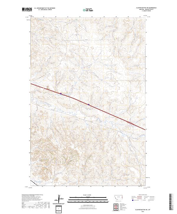
2024 Map of Cluster Buttes SW
USGS Topo · Published 2024About this map
Griffith Creek and Krug Creek meander through the high plains of Dawson County, carving a series of drainages across this section of eastern Montana. This 2024 landscape is primarily organized by the Public Land Survey System, with township and range lines like t15n r58e and t16n r57e defining the agricultural and ranching parcels. The terrain is characterized by a network of rural routes, including RD 322 and RD 330, which follow the contours of the land rather than a strict grid, illustrating how local topography dictates travel in this part of the state. In the southern reaches, Hodges Creek provides further evidence of the area's intricate seasonal water system, which is vital for the livestock operations that dominate this open country.
Find a feature on this map
15 named features on this map. Tap any name to fly to it.
Don’t see what you’re looking for? This feature index may not catch every label — zoom into the map to look around manually.
Map Details
Editions of this 2024 Cluster Buttes SW Map
This is the sole edition of this map. No revisions or reprints were ever made.
Other maps of this area

1909 · Glendive
USGS Topo · 1:250,000

1953 · Miles City
USGS Topo · 1:250,000

1954 · Glendive
USGS Topo · 1:250,000

1957 · Miles City
USGS Topo · 1:250,000

1957 · Glendive
USGS Topo · 1:250,000

1958 · Miles City
USGS Topo · 1:250,000

1958 · Glendive
USGS Topo · 1:250,000

1967 · Allard
USGS Topo · 1:24,000

1967 · Belle Prairie
USGS Topo · 1:24,000

1967 · Twin Forks Reservoir
USGS Topo · 1:24,000