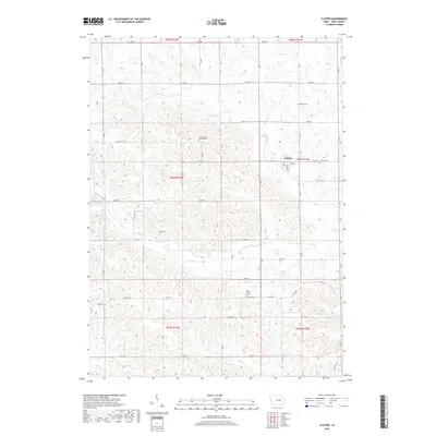
2018 Map of Clutier
USGS Topo · Published 2018About this map
Clutier sits at the heart of this agricultural landscape in Tama County, serving as the primary hub for the surrounding township sections. The town's local heritage is preserved through multiple family and religious burial grounds, including the Clutier Cem and the Saint Vaclav Catholic Cem. The terrain is defined by a dense network of watercourses that have shaped the land use, most notably Salt Cr and Wolf Cr, which drain the undulating fields. Smaller tributaries like Kibbe Cr and Simpson Cr weave through the rural grid. Further south, the presence of Holy Trinity Cem and the isolated Wiese Cem near S Br Salt Cr points to a long history of rural settlement and community structure tied to the section lines of the Public Land Survey System.
Find a feature on this map
37 named features on this map. Tap any name to fly to it.
Don’t see what you’re looking for? This feature index may not catch every label — zoom into the map to look around manually.
Map Details
Editions of this 2018 Clutier Map
This is the sole edition of this map. No revisions or reprints were ever made.
Other maps of this area

1954 · Waterloo
USGS Topo · 1:250,000

1954 · Des Moines
USGS Topo · 1:250,000

1955 · Waterloo
USGS Topo · 1:250,000

1956 · Des Moines
USGS Topo · 1:250,000

1957 · Des Moines
USGS Topo · 1:250,000

1968 · Belle Plaine
USGS Topo · 1:24,000

1968 · Chelsea
USGS Topo · 1:24,000

1969 · Des Moines
USGS Topo · 1:250,000

1971 · Gladbrook NE
USGS Topo · 1:24,000
1971 · Elberon
USGS Topo · 1:24,000