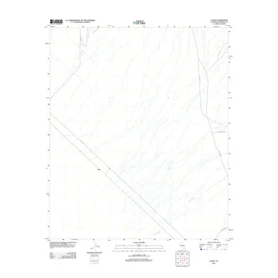
2012 Map of Clyde
USGS Topo · Published 2012About this map
Clyde sits at the junction of several desert transit routes in this arid portion of Imperial County, defined by a network of braided seasonal drainages. The landscape is primarily shaped by the hydrology of Indian Wash, which winds through the eastern and southern sections of the quadrangle. Transport infrastructure dominates the human footprint here, with Blythe Ogilby Rd and Ted Kipf Rd providing the primary access through the desert flats. The naming of Vista Mine Rd in the north and Gold Rock Rd in the southeast points to the region's historical and contemporary ties to mineral extraction. Other local connectors like Indian Pass Rd and Walker Way link this remote area to the broader Colorado Desert transit network.
Find a feature on this map
8 named features on this map. Tap any name to fly to it.
Don’t see what you’re looking for? This feature index may not catch every label — zoom into the map to look around manually.
Map Details
Editions of this 2012 Clyde Map
This is the sole edition of this map. No revisions or reprints were ever made.
Other maps of this area

1903 · Yuma
USGS Topo · 1:125,000

1905 · Yuma
USGS Topo · 1:125,000

1907 · Holtville
USGS Topo · 1:125,000

1942 · El Centro
USGS Topo · 1:250,000

1942 · Yuma
USGS Topo · 1:250,000

1942 · Blythe
USGS Topo · 1:250,000

1953 · Quartz Peak
USGS Topo · 1:62,500

1953 · Ogilby
USGS Topo · 1:62,500

1953 · Cactus
USGS Topo · 1:24,000

1953 · Acolita
USGS Topo · 1:62,500