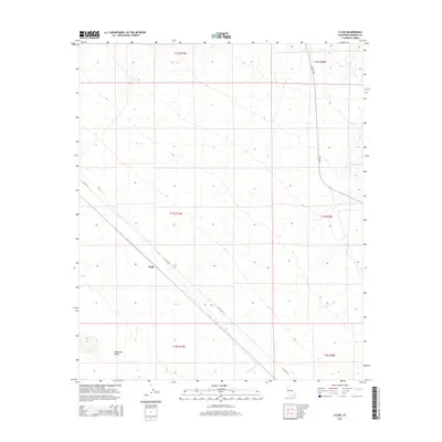
2015 Map of Clyde
USGS Topo · Published 2015About this map
The settlement of Clyde serves as a central landmark in this portion of the Colorado Desert within Imperial County. The landscape is defined by the ephemeral drainage of Indian Wash, which cuts across the southeastern quadrant, and the shifting sands of the Algodones Dunes appearing in the southwest. Transportation in this arid environment is facilitated by two primary corridors: the diagonal route of Ted Kipf Rd and the north-south alignment of Ogilby Rd. This 2015 survey reflects the modern configuration of the Public Land Survey System, as indicated by the prominent township and range boundaries including t14s r19e and t13s r20e, which organize the seemingly empty expanse into a precise geographic grid.
Find a feature on this map
10 named features on this map. Tap any name to fly to it.
Don’t see what you’re looking for? This feature index may not catch every label — zoom into the map to look around manually.
Map Details
Editions of this 2015 Clyde Map
This is the sole edition of this map. No revisions or reprints were ever made.
Other maps of this area

1903 · Yuma
USGS Topo · 1:125,000

1905 · Yuma
USGS Topo · 1:125,000

1907 · Holtville
USGS Topo · 1:125,000

1942 · El Centro
USGS Topo · 1:250,000

1942 · Yuma
USGS Topo · 1:250,000

1942 · Blythe
USGS Topo · 1:250,000

1953 · Quartz Peak
USGS Topo · 1:62,500

1953 · Ogilby
USGS Topo · 1:62,500

1953 · Cactus
USGS Topo · 1:24,000

1953 · Acolita
USGS Topo · 1:62,500