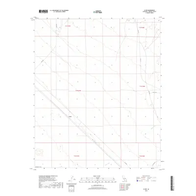
2018 Map of Clyde
USGS Topo · Published 2018About this map
Clyde occupies a central position in this arid Imperial County landscape, situated along a prominent transit corridor that cuts northwest to southeast across the terrain. The topography is defined by the vast sands of the Algodones Dunes in the southwest corner, while the northeast is characterized by more dissected surfaces and drainage patterns. Indian Wash provides a primary natural channel through the southern portion of the sheet, illustrating the ephemeral water systems of the California desert. The infrastructure of the area is represented by a network of specialized routes, including Vista Mine Rd and Ted Kiff Rd, which suggest past or present industrial and mining access. Further north and east, roads such as Indian Pass Rd and Walker Way link the area to the wider regional grid, including Co Hwy S34 and Gold Rock Rd.
Find a feature on this map
15 named features on this map. Tap any name to fly to it.
Don’t see what you’re looking for? This feature index may not catch every label — zoom into the map to look around manually.
Map Details
Editions of this 2018 Clyde Map
This is the sole edition of this map. No revisions or reprints were ever made.
Other maps of this area

1903 · Yuma
USGS Topo · 1:125,000

1905 · Yuma
USGS Topo · 1:125,000

1907 · Holtville
USGS Topo · 1:125,000

1942 · El Centro
USGS Topo · 1:250,000

1942 · Yuma
USGS Topo · 1:250,000

1942 · Blythe
USGS Topo · 1:250,000

1953 · Quartz Peak
USGS Topo · 1:62,500

1953 · Ogilby
USGS Topo · 1:62,500

1953 · Cactus
USGS Topo · 1:24,000

1953 · Acolita
USGS Topo · 1:62,500