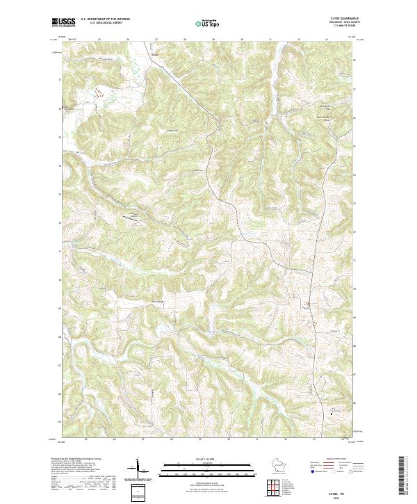
2022 Map of Clyde
USGS Topo · Published 2022About this map
The unincorporated settlement of Clyde serves as a central point in this rural landscape of Iowa and Wisconsin, where the terrain is defined by deep drainages like Norwegian Hollow and high points such as Union Ridge. The area is marked by a history of local congregations and family lineages, evidenced by the presence of Saint Malachy Cem in the northwest and Rock Church Cem in the southeast. Water remains a defining feature of the topography, with Otter Cr and Dickinson Cr winding through the valleys, while geologic landmarks like Percussion Rock and Deer Shelter Rock stand as distinctive natural monuments. Smaller aviation interests are represented by Southwind Airport, which sits tucked into the hills south of Hunter Hollow. This modern survey by the U.S. Geological Survey provides a clear view of how rural road networks, including Co Rd I and Co Rd M, navigate the complex ridges and hollows of the Driftless Area.
Find a feature on this map
63 named features on this map. Tap any name to fly to it.
Don’t see what you’re looking for? This feature index may not catch every label — zoom into the map to look around manually.
Map Details
Editions of this 2022 Clyde Map
This is the sole edition of this map. No revisions or reprints were ever made.
Other maps of this area

1902 · Mineral Point
USGS Topo · 1:125,000

1905 · Richland Center
USGS Topo · 1:125,000

1952 · Dodgeville
USGS Topo · 1:24,000

1952 · Linden
USGS Topo · 1:24,000

1958 · La Crosse
USGS Topo · 1:250,000

1959 · Dubuque
USGS Topo · 1:250,000

1960 · Muscoda
USGS Topo · 1:62,500

1960 · Spring Green
USGS Topo · 1:62,500

1961 · Dubuque
USGS Topo · 1:250,000

1961 · La Crosse
USGS Topo · 1:250,000