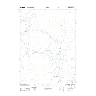
2012 Map of Coad Mountain
USGS Topo · Published 2012About this map
Coad Mountain and Pennock Mountain define the high country of this Wyoming landscape, where the terrain drops sharply into Pass Creek Canyon. The map documents a complex system of high-altitude water management, notably the Little Brush Creek Ditch, which redirects water across the slopes near Brush Cr and Pass Cr. This network of creeks—including Jack Cr, Fox Cr, and Finn Cr—converges toward the Johnson Ranch, a primary point of human settlement in this high-basin environment.
Find a feature on this map
34 named features on this map. Tap any name to fly to it.
Don’t see what you’re looking for? This feature index may not catch every label — zoom into the map to look around manually.
Map Details
Editions of this 2012 Coad Mountain Map
This is the sole edition of this map. No revisions or reprints were ever made.
Other maps of this area

1893 · Fort Steele
USGS Topo · 1:125,000

1906 · Medicine Bow
USGS Topo · 1:125,000

1908 · Medicine Bow
USGS Topo · 1:125,000

1939 · Saratoga
USGS Topo · 1:125,000

1954 · Rawlins
USGS Topo · 1:250,000

1955 · Coal Bank Basin
USGS Topo · 1:24,000

1955 · Elk Mountain
USGS Topo · 1:24,000

1955 · Elk Mountain SW
USGS Topo · 1:24,000

1955 · Oberg Ranch
USGS Topo · 1:24,000

1955 · Rattlesnake Pass
USGS Topo · 1:24,000