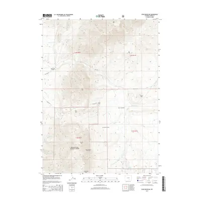
2015 Map of Coad Mountain
USGS Topo · Published 2015About this map
Medicine Bow National Forest encompasses the southern portion of this Carbon County landscape, where the northern reaches of the Medicine Bow Mountains rise above the surrounding basins. This high-altitude terrain is defined by prominent peaks including Coad Mtn and Pennock Mtn, which overlook the expansive Pass Creek Basin. The area is geographically notable for its drainage patterns, with numerous creeks such as Pass Cr, Finn Cr, and Lemoine Cr carving through the mountain slopes. The historic path of the Cherokee Trl crosses the central region near Indian Hill, marking a corridor of movement across this portion of Wyoming. Low-lying areas like Loco Bottom Basin contrast with the steeper topography of Pass Creek Canyon, providing a detailed look at the complex landforms used by ranchers and outdoorsmen in the 21st century.
Find a feature on this map
40 named features on this map. Tap any name to fly to it.
Don’t see what you’re looking for? This feature index may not catch every label — zoom into the map to look around manually.
Map Details
Editions of this 2015 Coad Mountain Map
This is the sole edition of this map. No revisions or reprints were ever made.
Other maps of this area

1893 · Fort Steele
USGS Topo · 1:125,000

1906 · Medicine Bow
USGS Topo · 1:125,000

1908 · Medicine Bow
USGS Topo · 1:125,000

1939 · Saratoga
USGS Topo · 1:125,000

1954 · Rawlins
USGS Topo · 1:250,000

1955 · Coal Bank Basin
USGS Topo · 1:24,000

1955 · Elk Mountain
USGS Topo · 1:24,000

1955 · Elk Mountain SW
USGS Topo · 1:24,000

1955 · Oberg Ranch
USGS Topo · 1:24,000

1955 · Rattlesnake Pass
USGS Topo · 1:24,000