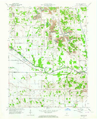
1963 Map of Coal City
USGS Topo · Published 1972About this map
Coal City and the surrounding townships of Harrison and Jefferson define this landscape, where the legacies of heavy industry and early transportation intersect. The map documents an extensive network of Strip Mine operations scattered across the terrain, particularly around Stockton and Daggett. Below the industrial works, the meandering path of the Eel River flows through the southern half of the quadrangle, paralleled by the historical trace of the Wabash and Erie Canal (Abandoned). This waterway once served as a primary artery for Indiana commerce before the rise of the railroads.
Find a feature on this map
64 named features on this map. Tap any name to fly to it.
Don’t see what you’re looking for? This feature index may not catch every label — zoom into the map to look around manually.
Map Details
Editions of this 1963 Coal City Map
4 editions found
Other maps of this area

1908 · Clay City
USGS Topo · 1:48,000

1908 · Bloomfield
USGS Topo · 1:62,500

1910 · Clay City
USGS Topo · 1:62,500

1938 · Coal City
USGS Topo · 1:24,000

1938 · Switz City
USGS Topo · 1:24,000

1940 · Linton
USGS Topo · 1:24,000

1940 · Jasonville
USGS Topo · 1:24,000

1947 · Switz City
USGS Topo · 1:24,000

1947 · Linton
USGS Topo · 1:24,000

1948 · Coal City
USGS Topo · 1:24,000