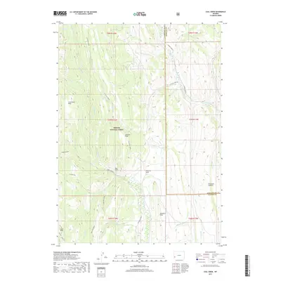
2017 Map of Coal Creek
USGS Topo · Published 2017About this map
Bridger National Forest dominates this section of the Overthrust Belt, where the complex geology of the Fontenelle Hogbacks and Commissary Ridge defines the high-altitude landscape. This 2017 survey illustrates the dense network of drainages feeding the Green River basin, including Fontenelle Cr, La Barge Cr, and Little Fall Creek. The map records a wilderness largely accessible only by forest routes like La Barge Creek Rd and Little Fall Creek Rd. Topographic features such as Absaroka Ridge and Pomeroy Basin reflect the distinctive landforms of western Wyoming. Further south, the boundary of Fontenelle Forest and landmarks like Mahogany Ridge provide critical reference points for land use and conservation studies in the Lincoln and Sublette County borderlands.
Find a feature on this map
45 named features on this map. Tap any name to fly to it.
Don’t see what you’re looking for? This feature index may not catch every label — zoom into the map to look around manually.
Map Details
Editions of this 2017 Coal Creek Map
This is the sole edition of this map. No revisions or reprints were ever made.
Other maps of this area

1936 · Cokeville
USGS Topo · 1:96,000

1942 · Cokeville
USGS Topo · 1:125,000

1945 · Fort Hill
USGS Topo · 1:62,500

1947 · Fort Hill
USGS Topo · 1:62,500

1955 · Preston
USGS Topo · 1:250,000

1958 · Preston
USGS Topo · 1:250,000

1962 · Preston
USGS Topo · 1:250,000
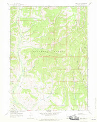
1967 · Pole Creek
USGS Topo · 1:24,000

1967 · Devils Hole Creek
USGS Topo · 1:24,000

1967 · Graham Peak
USGS Topo · 1:24,000