
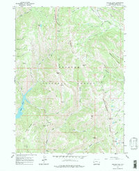
1967 Map of Graham Peak
USGS Topo · Published 1970About this map
Commissary Ridge and Absaroka Ridge dominate this high-altitude landscape in the Bridger National Forest, as mapped in the late 1960s. The topography is defined by significant elevations, including Graham Peak, Mount Isabel, and Fontenelle Mountain, which overlook a complex network of high mountain drainages. The hydrology of the area is centered on Alice Lake and the Fontenelle Lakes, with numerous smaller bodies like Twin Creek Lakes and Travis Lake pocketing the peaks.
Find a feature on this map
44 named features on this map. Tap any name to fly to it.
Don’t see what you’re looking for? This feature index may not catch every label — zoom into the map to look around manually.
Map Details
Editions of this 1967 Graham Peak Map
2 editions found
Other maps of this area

1921 · Afton
USGS Topo · 1:125,000

1936 · Cokeville
USGS Topo · 1:96,000

1942 · Cokeville
USGS Topo · 1:125,000

1955 · Preston
USGS Topo · 1:250,000

1958 · Preston
USGS Topo · 1:250,000

1962 · Preston
USGS Topo · 1:250,000

1967 · Devils Hole Creek
USGS Topo · 1:24,000

1967 · Big Park
USGS Topo · 1:24,000

1967 · Porcupine Creek
USGS Topo · 1:24,000
1967 · Coal Creek
USGS Topo · 1:24,000