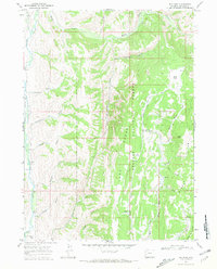
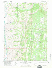
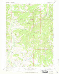
1967 Map of Big Park
USGS Topo · Published 1970About this map
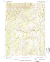
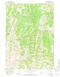
Bridger National Forest dominates this Wyoming landscape, where the Tunp Range and Middle Ridge define a high-altitude wilderness of creek drainages and secluded flats. In the late 1960s, this area served primarily as a managed forest environment, evidenced by the Kelley Guard Sta and the distant Smiths Fork Guard Sta 13 Mi. The topography is marked by significant hydrological features, including the southward-flowing Smiths Fork and the headwaters of Hams Fork.
Find a feature on this map
40 named features on this map. Tap any name to fly to it.
Don’t see what you’re looking for? This feature index may not catch every label — zoom into the map to look around manually.
Map Details
Editions of this 1967 Big Park Map
2 editions found
Other maps of this area
1936 · Cokeville
USGS Topo · 1:96,000
1942 · Cokeville
USGS Topo · 1:125,000

1955 · Preston
USGS Topo · 1:250,000

1958 · Preston
USGS Topo · 1:250,000

1962 · Preston
USGS Topo · 1:250,000
1967 · Pole Creek
USGS Topo · 1:24,000
1967 · Devils Hole Creek
USGS Topo · 1:24,000
1967 · Graham Peak
USGS Topo · 1:24,000
1967 · Huff Lake
USGS Topo · 1:24,000
1967 · Porcupine Creek
USGS Topo · 1:24,000