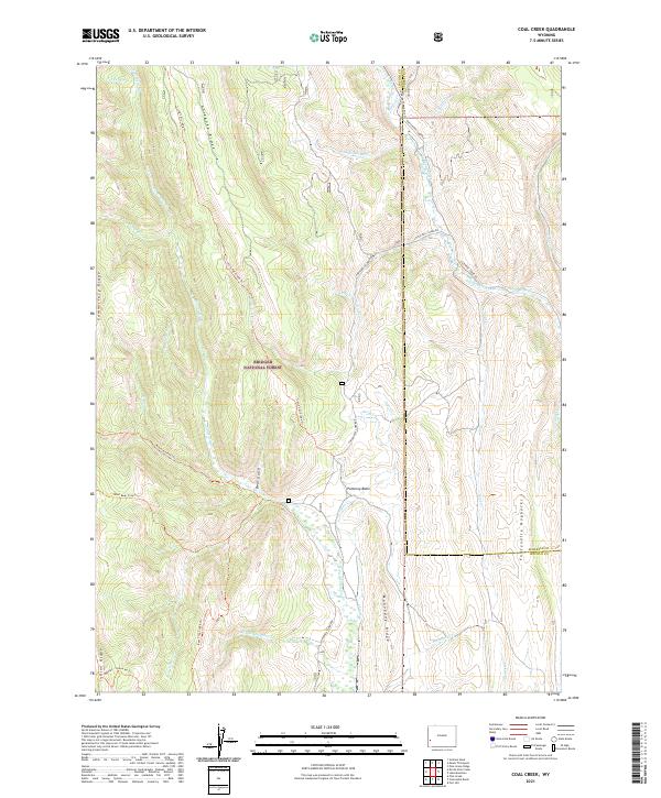
2021 Map of Coal Creek
USGS Topo · Published 2021About this map
Absaroka Ridge and Commissary Ridge dominate this section of the Bridger National Forest, forming a high-elevation landscape defined by sharp topographical relief and extensive drainage networks. The map details the headwaters of numerous streams, including Fontenelle Cr and La Barge Creek, which carve through the Fontenelle Hogbacks and the Pomeroy Basin. This area in western Wyoming is characterized by its isolation and its role as a resource for forest management and recreation.
Find a feature on this map
45 named features on this map. Tap any name to fly to it.
Don’t see what you’re looking for? This feature index may not catch every label — zoom into the map to look around manually.
Map Details
Editions of this 2021 Coal Creek Map
This is the sole edition of this map. No revisions or reprints were ever made.
Other maps of this area

1936 · Cokeville
USGS Topo · 1:96,000

1942 · Cokeville
USGS Topo · 1:125,000

1945 · Fort Hill
USGS Topo · 1:62,500

1947 · Fort Hill
USGS Topo · 1:62,500

1955 · Preston
USGS Topo · 1:250,000

1958 · Preston
USGS Topo · 1:250,000

1962 · Preston
USGS Topo · 1:250,000
1967 · Pole Creek
USGS Topo · 1:24,000

1967 · Devils Hole Creek
USGS Topo · 1:24,000

1967 · Graham Peak
USGS Topo · 1:24,000