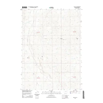
2015 Map of Coal Hill
USGS Topo · Published 2015About this map
The high plains of Converse County are defined here by the Sage Creek Divide, a prominent ridge separating the intricate drainage networks of the region. To the north, the S Fork Dry Fork Cheyenne River and Phillips Cr carve through the landscape, while Sage Cr and the S Fork Sage Cr flow toward the south and east. This 2015 survey illustrates a sparsely populated ranching environment where landmark features like Red Butte and Coal Hill serve as primary navigational points.
Find a feature on this map
16 named features on this map. Tap any name to fly to it.
Don’t see what you’re looking for? This feature index may not catch every label — zoom into the map to look around manually.
Map Details
Editions of this 2015 Coal Hill Map
This is the sole edition of this map. No revisions or reprints were ever made.
Other maps of this area

1949 · Leuenberger Ranch
USGS Topo · 1:24,000

1949 · Glenrock NW
USGS Topo · 1:24,000

1949 · Hylton Ranch
USGS Topo · 1:24,000

1950 · Leuenberger Ranch
USGS Topo · 1:24,000

1950 · Glenrock NW
USGS Topo · 1:24,000
1950 · Hylton Ranch
USGS Topo · 1:24,000

1954 · Torrington
USGS Topo · 1:250,000

1955 · Newcastle
USGS Topo · 1:250,000

1958 · Torrington
USGS Topo · 1:250,000

1958 · Newcastle
USGS Topo · 1:250,000