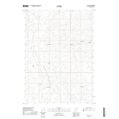
2017 Map of Coal Hill
USGS Topo · Published 2017About this map
Coal Hill and Red Butte anchor the southern reaches of this Converse County landscape, where the high plains break into a complex system of drainage basins. The terrain is defined by the Sage Creek Divide, a prominent ridgeline separating the northern flowing S Fork Dry Fork Cheyenne River and Phillips Cr from the southern waters of Sage Cr. In the northeastern quadrant, the small settlement of Blizzard Heights is situated along Blizzard Heights road, representing a pocket of modern development amidst the expansive ranching and public land survey system. This 2017 survey details the network of county roads, including Co Rd 23, that navigate the undulating topography and seasonal watercourses like Deep Draw and Sand Cr.
Find a feature on this map
16 named features on this map. Tap any name to fly to it.
Don’t see what you’re looking for? This feature index may not catch every label — zoom into the map to look around manually.
Map Details
Editions of this 2017 Coal Hill Map
This is the sole edition of this map. No revisions or reprints were ever made.
Other maps of this area

1949 · Leuenberger Ranch
USGS Topo · 1:24,000

1949 · Glenrock NW
USGS Topo · 1:24,000

1949 · Hylton Ranch
USGS Topo · 1:24,000

1950 · Leuenberger Ranch
USGS Topo · 1:24,000

1950 · Glenrock NW
USGS Topo · 1:24,000
1950 · Hylton Ranch
USGS Topo · 1:24,000

1954 · Torrington
USGS Topo · 1:250,000

1955 · Newcastle
USGS Topo · 1:250,000

1958 · Torrington
USGS Topo · 1:250,000

1958 · Newcastle
USGS Topo · 1:250,000