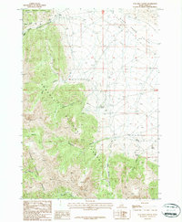
1987 Map of Coal Kiln Canyon
USGS Topo · Published 1987About this map
Hahn marks a historical point of interest at the northern edge of this Lemhi County landscape, where the high desert terrain of Birch Creek Valley meets the rising slopes of the Beaverhead Mountains. The map reveals a history of resource extraction and water management, highlighted by various prospects and a named Kiln located near Cool Kiln Spring. These features, along with several gravel pits, point to the area's small-scale mining and industrial activity during the late 20th century.
Find a feature on this map
29 named features on this map. Tap any name to fly to it.
Don’t see what you’re looking for? This feature index may not catch every label — zoom into the map to look around manually.
Map Details
Editions of this 1987 Coal Kiln Canyon Map
This is the sole edition of this map. No revisions or reprints were ever made.
Other maps of this area

1955 · Dubois
USGS Topo · 1:250,000

1956 · Nicholia
USGS Topo · 1:62,500

1957 · Diamond Peak
USGS Topo · 1:62,500

1957 · Gilmore
USGS Topo · 1:62,500

1957 · Hawley Mountain
USGS Topo · 1:62,500

1958 · Dubois
USGS Topo · 1:250,000

1987 · Gilmore
USGS Topo · 1:24,000
1987 · Mulkey Bar
USGS Topo · 1:24,000
1987 · Gilmore Summit
USGS Topo · 1:24,000
1987 · Nicholia
USGS Topo · 1:24,000