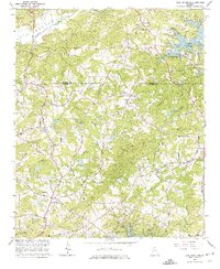
1964 Map of Coal Mountain
USGS Topo · Published 1974About this map
Lumpkin and Silver City anchor the rural landscape of northern Georgia in this mid-1960s survey, where the winding Etowah River and Savannah River define the headwaters. The topography is marked by deeply cut drainage systems like Settingdown Creek and Black Mill Creek, showing a transition from traditional upland farming toward the emerging recreational footprint of Lake Sidney Lanier in the northeast.
Find a feature on this map
61 named features on this map. Tap any name to fly to it.
Don’t see what you’re looking for? This feature index may not catch every label — zoom into the map to look around manually.
Map Details
Editions of this 1964 Coal Mountain Map
3 editions found
Other maps of this area

1890 · Suwanee
USGS Topo · 1:125,000

1891 · Gainesville
USGS Topo · 1:125,000

1894 · Suwanee
USGS Topo · 1:125,000

1954 · Greenville
USGS Topo · 1:250,000

1955 · Rome
USGS Topo · 1:250,000

1958 · Greenville
USGS Topo · 1:250,000

1958 · Rome
USGS Topo · 1:250,000

1961 · Rome
USGS Topo · 1:250,000

1963 · Rome
USGS Topo · 1:250,000

1964 · Murrayville
USGS Topo · 1:24,000