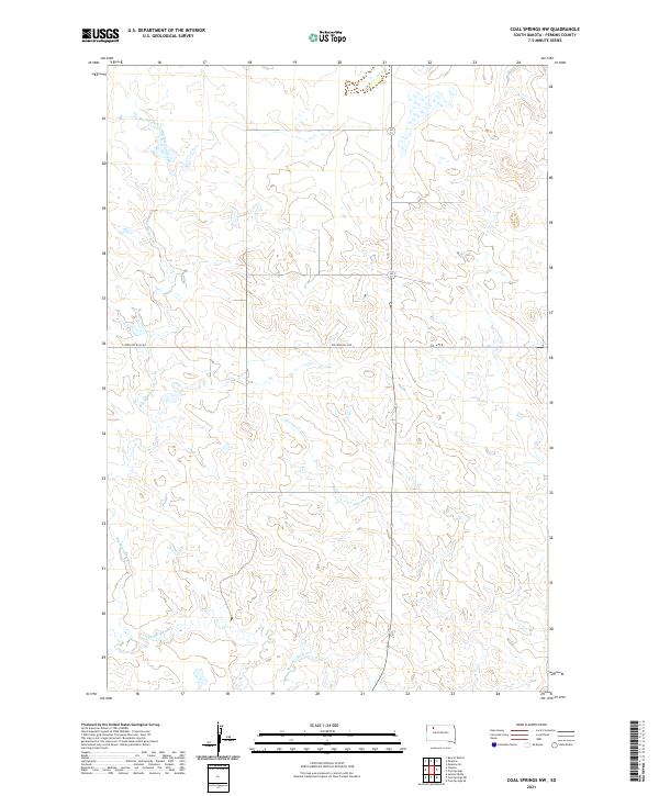
2021 Map of Coal Springs NW
USGS Topo · Published 2021About this map
The upper reaches of Big Meadow Creek and its many smaller tributaries define the subtle topography of this corner of Perkins County. At the time of this 2021 study, the landscape remains largely defined by the drainage patterns of Duncan Cr and Thunder Butte Cr, which carve through the open grassland of western South Dakota. Sparse human infrastructure is represented primarily by Rolling Hills Rd, which provides one of the few through-routes across the township divisions of T17N and T18N. The map reveals the characteristic section-line development typical of the High Plains, where ranching and agricultural activity are anchored to the intermittent water sources like Big Meadow Cr.
Find a feature on this map
11 named features on this map. Tap any name to fly to it.
Don’t see what you’re looking for? This feature index may not catch every label — zoom into the map to look around manually.
Map Details
Editions of this 2021 Coal Springs NW Map
This is the sole edition of this map. No revisions or reprints were ever made.
Other maps of this area

1954 · Lemmon
USGS Topo · 1:250,000

1957 · Lemmon
USGS Topo · 1:250,000

1983 · Boxcar Buttes
USGS Topo · 1:24,000

1983 · Coal Springs
USGS Topo · 1:24,000

1983 · Sunrise Butte
USGS Topo · 1:24,000

1983 · Meadow
USGS Topo · 1:24,000

1983 · Coal Springs SW
USGS Topo · 1:24,000
1983 · Coal Springs SE
USGS Topo · 1:24,000
1983 · Meadow SE
USGS Topo · 1:24,000

1983 · Coal Springs NW
USGS Topo · 1:24,000