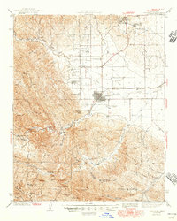
1944 Map of Coalinga
USGS Topo · Published 1944About this map
The industrial and agricultural footprint of western Fresno County during World War II is anchored by the Coalinga Oil Refinery and the established town center of Coalinga. To the north, the landscape is defined by the energy sector with several worker outposts such as Camp 7-C and Camp 25-D, alongside the appropriately named Oilfields settlement. The Southern Pacific railroad provides the essential link for transporting these resources across the Central Valley.
Find a feature on this map
68 named features on this map. Tap any name to fly to it.
Don’t see what you’re looking for? This feature index may not catch every label — zoom into the map to look around manually.
Map Details
Editions of this 1944 Coalinga Map
3 editions found
Other maps of this area

1912 · Coalinga
USGS Topo · 1:125,000

1914 · Cholame
USGS Topo · 1:125,000

1915 · Priest Valley
USGS Topo · 1:125,000

1915 · Cholame
USGS Topo · 1:125,000

1917 · Cholame
USGS Topo · 1:125,000

1919 · San Miguel
USGS Topo · 1:62,500

1928 · Delta Farms No 3
USGS Topo · 1:31,680

1930 · Canoas Creek
USGS Topo · 1:31,680

1932 · Delta Farms
USGS Topo · 1:31,680

1933 · Guijarral Hills
USGS Topo · 1:31,680