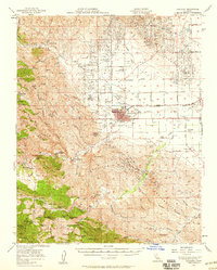
1956 Map of Coalinga
USGS Topo · Published 1958About this map
Coalinga stands as a hub of mid-century industrial activity, dominated by the extensive Coalinga Oil Field and Jacalitos Oil Field that flank the town. The landscape is a network of oil tanks, oil reservoirs, and pumping stations, illustrating the region's reliance on petroleum production. Beyond the drilling sites, the town center features essential civic structures like the Jr College and a cemetery, while entertainment is found at the Drive-in Theater and Coalinga Sulphur Baths.
Find a feature on this map
111 named features on this map. Tap any name to fly to it.
Don’t see what you’re looking for? This feature index may not catch every label — zoom into the map to look around manually.
Map Details
Editions of this 1956 Coalinga Map
2 editions found
Other maps of this area

1912 · Coalinga
USGS Topo · 1:125,000

1914 · Cholame
USGS Topo · 1:125,000

1915 · Priest Valley
USGS Topo · 1:125,000

1915 · Cholame
USGS Topo · 1:125,000

1917 · Cholame
USGS Topo · 1:125,000

1919 · San Miguel
USGS Topo · 1:62,500

1928 · Delta Farms No 3
USGS Topo · 1:31,680

1930 · Canoas Creek
USGS Topo · 1:31,680

1932 · Delta Farms
USGS Topo · 1:31,680

1933 · Guijarral Hills
USGS Topo · 1:31,680