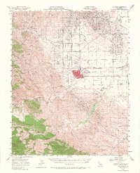
1956 Map of Coalinga
USGS Topo · Published 1967About this map
Coalinga serves as the industrial and educational center of this West Side landscape, marked by its namesake Coalinga College and a sprawling network of oil infrastructure. The surrounding terrain is defined by the Jacalitos Hills and Kreyenhagen Hills, where the economy of the mid-1950s is etched into the earth through numerous Oil Tanks, Oil Reservoirs, and the Coalinga Nose feature. The survey meticulously records the transition from the concentrated grid of the city to the remote reaches of the Fresno and Monterey county line.
Find a feature on this map
66 named features on this map. Tap any name to fly to it.
Don’t see what you’re looking for? This feature index may not catch every label — zoom into the map to look around manually.
Map Details
Editions of this 1956 Coalinga Map
2 editions found
Other maps of this area

1912 · Coalinga
USGS Topo · 1:125,000

1914 · Cholame
USGS Topo · 1:125,000

1915 · Priest Valley
USGS Topo · 1:125,000

1915 · Cholame
USGS Topo · 1:125,000

1917 · Cholame
USGS Topo · 1:125,000

1919 · San Miguel
USGS Topo · 1:62,500

1928 · Delta Farms No 3
USGS Topo · 1:31,680

1930 · Canoas Creek
USGS Topo · 1:31,680

1932 · Delta Farms
USGS Topo · 1:31,680

1933 · Guijarral Hills
USGS Topo · 1:31,680