
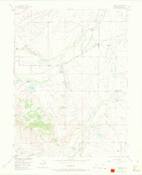
1955 Map of Coalmont
USGS Topo · Published 1957About this map
Coalmont and the surrounding ranchlands of North Park define this mid-century landscape, where coal extraction and cattle ranching coexist along the upper reaches of the Little Grizzly Creek drainage. The Union Pacific railroad serves as the primary corridor for the region's industry, connecting the mining operations at Open Pit Mine and Coal Mines with the small rail stop at Hebron. The map provides a detailed view of the high-altitude ranching economy, identifying numerous family-named properties such as Mellen Ranch, Wamsley Cattle Ranch, and Turpen Ranch. In the more remote southern sections, the terrain rises toward Pole Mountain, where water management is visible through features like Fuller Reservoir and the Wisconsin Ditch, supporting agriculture in this semi-arid basin. A single school, Spicer Sch, is located in the southeastern corner, highlighting the sparse settlement pattern of the era.
Find a feature on this map
35 named features on this map. Tap any name to fly to it.
Don’t see what you’re looking for? This feature index may not catch every label — zoom into the map to look around manually.
Map Details
Editions of this 1955 Coalmont Map
3 editions found
Other maps of this area

1911 · Hahns Peak
USGS Topo · 1:125,000

1913 · Hahns Peak
USGS Topo · 1:125,000

1954 · Craig
USGS Topo · 1:250,000

1955 · Pitchpine Mountain
USGS Topo · 1:24,000

1955 · Teal Lake
USGS Topo · 1:24,000

1955 · Delaney Butte
USGS Topo · 1:24,000

1955 · Walden
USGS Topo · 1:24,000

1955 · Mac Farlane Reservoir
USGS Topo · 1:24,000

1955 · Mount Ethel
USGS Topo · 1:62,500

1955 · Walden
USGS Topo · 1:62,500