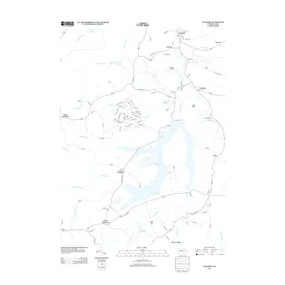
2013 Map of Coalport
USGS Topo · Published 2013About this map
Glendale Lake dominates the central landscape of this Beccaria Township region, its irregular shoreline reaching into the surrounding drainages of Burgoon Run and Killbuck Run. The northern sector is anchored by Coalport and Lyleville, where a dense network of local roads like Cemetery Rd and Hegarty Rd suggests a more established residential and commercial footprint. To the south and east, smaller settlements such as Flinton and Fiske sit along the winding course of Clearfield Cr. This 2013 survey illustrates a rural Pennsylvania landscape where modern recreational geography at the lake meets older crossroads communities. Notable landmarks like Barnhart Airport and Irvona Reservoir provide specific points of interest for local historians, while the rugged topography is defined by features like Snake Ridge and the many runs feeding the local watershed.
Find a feature on this map
99 named features on this map. Tap any name to fly to it.
Don’t see what you’re looking for? This feature index may not catch every label — zoom into the map to look around manually.
Map Details
Editions of this 2013 Coalport Map
This is the sole edition of this map. No revisions or reprints were ever made.
Other maps of this area

1902 · Patton
USGS Topo · 1:62,500

1903 · Curwensville
USGS Topo · 1:62,500

1903 · Houtzdale
USGS Topo · 1:62,500

1904 · Patton
USGS Topo · 1:62,500

1905 · Houtzdale
USGS Topo · 1:62,500

1920 · Altoona
USGS Topo · 1:62,500

1922 · Altoona
USGS Topo · 1:62,500

1939 · Curwensville
USGS Topo · 1:62,500

1942 · Curwensville
USGS Topo · 1:62,500

1943 · Punxsutawney
USGS Topo · 1:125,000