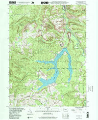
1998 Map of Coalport
USGS Topo · Published 1999About this map
Glendale Lake serves as the central anchor of this landscape, dominated by the expansive Prince Gallitzin State Park and surrounding timberlands. Situated along the boundary of Clearfield County and Cambria County, the area showcases a transition from industrial activity to recreational conservation. Evidence of the region’s extractive history is visible in the reclaimed strip mine areas and the legacy of coal transport found at Coalport.
Find a feature on this map
36 named features on this map. Tap any name to fly to it.
Don’t see what you’re looking for? This feature index may not catch every label — zoom into the map to look around manually.
Map Details
Editions of this 1998 Coalport Map
This is the sole edition of this map. No revisions or reprints were ever made.
Other maps of this area

1902 · Patton
USGS Topo · 1:62,500

1903 · Curwensville
USGS Topo · 1:62,500

1903 · Houtzdale
USGS Topo · 1:62,500

1904 · Patton
USGS Topo · 1:62,500

1905 · Houtzdale
USGS Topo · 1:62,500

1920 · Altoona
USGS Topo · 1:62,500

1922 · Altoona
USGS Topo · 1:62,500

1939 · Curwensville
USGS Topo · 1:62,500

1942 · Curwensville
USGS Topo · 1:62,500

1943 · Punxsutawney
USGS Topo · 1:125,000