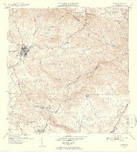
1952 Map of Coamo
USGS Topo · Published 1953About this map
Coamo serves as the focal point of this mid-century survey, situated where the historic Carretera Central navigates the southern slopes of the Asomante Cordillera Central. The landscape reveals a transition from the dense urban grid of the town center to a series of agricultural estates and rural settlements. To the south, numerous haciendas including Hacienda Buena Vista, Hacienda Esmeralda, and Hacienda Largo signify the area's deep-rooted plantation history along the banks of the Río Coamo and its tributaries.
Find a feature on this map
58 named features on this map. Tap any name to fly to it.
Don’t see what you’re looking for? This feature index may not catch every label — zoom into the map to look around manually.
Map Details
Editions of this 1952 Coamo Map
2 editions found
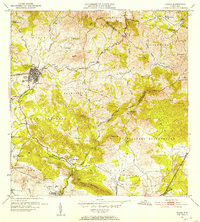
Other maps of this area

1944 · Santa Isabel
USGS Topo · 1:30,000

1945 · Rio Descalabrado
USGS Topo · 1:30,000

1945 · Central Aguirre
USGS Topo · 1:30,000

1945 · Salinas
USGS Topo · 1:30,000

1946 · Coamo
USGS Topo · 1:30,000

1946 · Barranquitas
USGS Topo · 1:30,000

1946 · Cayey
USGS Topo · 1:30,000

1946 · Comerio
USGS Topo · 1:30,000

1946 · Orocovis
USGS Topo · 1:30,000

1947 · Cayey NO
USGS Topo · 1:10,000