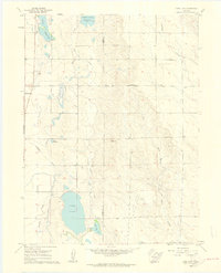
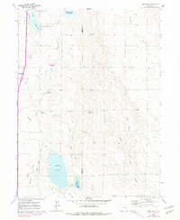
1960 Map of Cobb Lake
USGS Topo · Published 1962About this map
Cobb Lake and the surrounding irrigation network dominate this Weld County landscape, reflecting the intensive water management required for high-plains agriculture. The topography is defined by the Windsor Ditch and numerous storage sites including Indian Creek Reservoir, Clark Reservoir, and Morris Reservoir. Near the western edge, the town of Wellington appears alongside the Highland Cem, serving as a local hub for the surrounding farmsteads. The map illustrates a developed hydraulic system where natural drainages like Black Hollow Creek and Boxelder Creek are diverted and utilized through various laterals. Prominent landforms such as Cactus Hill rise above the basin, providing a contrast to the reservoir-dotted plains where early industrial activity is evidenced by scattered wells and gravel pits.
Find a feature on this map
19 named features on this map. Tap any name to fly to it.
Don’t see what you’re looking for? This feature index may not catch every label — zoom into the map to look around manually.
Map Details
Editions of this 1960 Cobb Lake Map
5 editions found
Other maps of this area

1906 · Fort Collins
USGS Topo · 1:62,500

1907 · Livermore
USGS Topo · 1:125,000

1908 · Fort Collins
USGS Topo · 1:62,500

1908 · Eaton
USGS Topo · 1:125,000

1909 · Livermore
USGS Topo · 1:125,000

1910 · Eaton
USGS Topo · 1:125,000

1954 · Greeley
USGS Topo · 1:250,000

1957 · Greeley
USGS Topo · 1:250,000

1958 · Greeley
USGS Topo · 1:250,000
1960 · Fort Collins
USGS Topo · 1:24,000