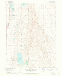
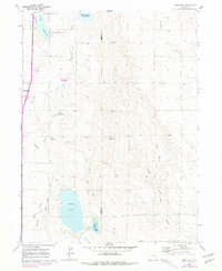
1960 Map of Cobb Lake
USGS Topo · Published 1971About this map
The Larimer and Weld County line divides this agricultural landscape as it appeared in the mid-twentieth century, characterized by an intricate network of irrigation infrastructure. Water management is the primary driver of settlement patterns here, evidenced by the presence of Cobb Lake, Indian Creek Reservoir, and several smaller basins like Clark Reservoir and Morris Reservoir. The map illustrates the vital role of man-made waterways such as the Windsor Ditch and Cowan Lateral in supporting the high plains farms.
Find a feature on this map
20 named features on this map. Tap any name to fly to it.
Don’t see what you’re looking for? This feature index may not catch every label — zoom into the map to look around manually.
Map Details
Editions of this 1960 Cobb Lake Map
5 editions found
Other maps of this area

1906 · Fort Collins
USGS Topo · 1:62,500

1907 · Livermore
USGS Topo · 1:125,000

1908 · Fort Collins
USGS Topo · 1:62,500

1908 · Eaton
USGS Topo · 1:125,000

1909 · Livermore
USGS Topo · 1:125,000

1910 · Eaton
USGS Topo · 1:125,000

1954 · Greeley
USGS Topo · 1:250,000

1957 · Greeley
USGS Topo · 1:250,000

1958 · Greeley
USGS Topo · 1:250,000
1960 · Fort Collins
USGS Topo · 1:24,000