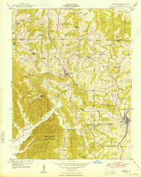
1948 Map of Cobden
USGS Topo · Published 1948About this map
Alto Pass and Cobden serve as the primary rail-connected hubs in this 1948 survey of southern Illinois, where the Gulf Mobile And Ohio and Illinois Central railroads dictate the movement of goods through the ridge-and-hollow terrain. The map captures a landscape defined by its rural institutions, with numerous country schools like Hambric School, Landreth School, and Union Point School serving scattered family farms. The high ground is dominated by the Shawnee National Forest and the Union County State Forest, where the Bald Knob Lookout Tower stands as a sentinel over the heavily wooded ridges.
Find a feature on this map
41 named features on this map. Tap any name to fly to it.
Don’t see what you’re looking for? This feature index may not catch every label — zoom into the map to look around manually.
Map Details
Editions of this 1948 Cobden Map
2 editions found
Other maps of this area

1920 · Jonesboro
USGS Topo · 1:62,500

1920 · Dongola
USGS Topo · 1:62,500

1922 · Carbondale
USGS Topo · 1:62,500

1923 · Dongola
USGS Topo · 1:62,500

1923 · Jonesboro
USGS Topo · 1:62,500

1924 · Alto Pass
USGS Topo · 1:62,500

1941 · Carbondale
USGS Topo · 1:62,500

1947 · Jonesboro
USGS Topo · 1:62,500

1947 · Alto Pass
USGS Topo · 1:62,500

1947 · Gorham
USGS Topo · 1:24,000