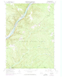
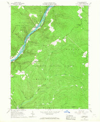
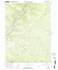
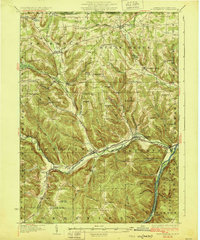
1966 Map of Cobham
USGS Topo · Published 1973About this map
Allegheny River navigation and timber-rich hillsides characterize this mid-century survey of the Pennsylvania wilderness. The river is marked by distinctive features such as Millstone Eddy, Shanley Eddy, and Stewards Island, reflecting its historical role in transport. Local history is preserved in small settlements and family-named intersections like Bimber Corners, McKean Corners, and Izenbrown Corners, while the presence of the Plank Road Sch suggests the early infrastructure of the Watson and Deerfield districts.
Find a feature on this map
63 named features on this map. Tap any name to fly to it.
Don’t see what you’re looking for? This feature index may not catch every label — zoom into the map to look around manually.
Map Details
Editions of this 1966 Cobham Map
3 editions found
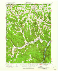
Other maps of this area

1906 · Warren
USGS Topo · 1:62,500

1907 · Warren
USGS Topo · 1:62,500

1908 · Warren
USGS Topo · 1:62,500
1926 · Youngsville
USGS Topo · 1:62,500

1927 · Tidioute
USGS Topo · 1:48,000
1929 · Youngsville
USGS Topo · 1:62,500

1930 · Tidioute
USGS Topo · 1:62,500

1935 · Sheffield
USGS Topo · 1:48,000

1941 · Sheffield
USGS Topo · 1:62,500
1943 · Youngsville
USGS Topo · 1:62,500
Featured Places
- Watson Township, PA
- Hickory Township, PA
- Magee, Deerfield Township
- Deerfield Township, PA
- Hearts Content, Watson Township