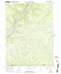
1966 Map of Cobham
USGS Topo · Published 1977About this map
The Allegheny River carves a deep valley through this timbered landscape, defining the boundaries of the Allegheny National Forest and local game lands. Along the river's path, distinctive river features like Stewards Island and Fuelhart Island appear alongside several eddies. The settlement pattern is largely defined by rural intersections and small villages such as Cobham, McKean Corners, and Izenbrown Corners.
Find a feature on this map
64 named features on this map. Tap any name to fly to it.
Don’t see what you’re looking for? This feature index may not catch every label — zoom into the map to look around manually.
Map Details
Editions of this 1966 Cobham Map
3 editions found
Other maps of this area

1906 · Warren
USGS Topo · 1:62,500

1907 · Warren
USGS Topo · 1:62,500

1908 · Warren
USGS Topo · 1:62,500

1926 · Youngsville
USGS Topo · 1:62,500

1927 · Tidioute
USGS Topo · 1:48,000

1929 · Youngsville
USGS Topo · 1:62,500

1930 · Tidioute
USGS Topo · 1:62,500

1935 · Sheffield
USGS Topo · 1:48,000

1941 · Sheffield
USGS Topo · 1:62,500

1943 · Youngsville
USGS Topo · 1:62,500