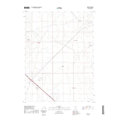
2021 Map of Cobre
USGS Topo · Published 2021About this map
Goshute Valley forms the central corridor of this Elko County landscape, a broad expanse situated between the high ridges of the Pequop Mountains to the west and the Toano Range to the east. The map documents the settlement at Oasis and the location of Cobre, positioned at the crossroads of transit routes through the high desert. Seasonal drainage patterns are visible through the paths of E Squaw Cr, Nanny Cr, and Sixmile Cr, which descend from the mountains toward the valley floor. This survey illustrates the modern transportation infrastructure and township boundaries that define this part of Nevada, providing a clear view of the area's topographic character and the sparse distribution of human settlements in this arid environment.
Find a feature on this map
12 named features on this map. Tap any name to fly to it.
Don’t see what you’re looking for? This feature index may not catch every label — zoom into the map to look around manually.
Map Details
Editions of this 2021 Cobre Map
This is the sole edition of this map. No revisions or reprints were ever made.
Other maps of this area

1955 · Wells
USGS Topo · 1:250,000

1955 · Elko
USGS Topo · 1:250,000

1958 · Wells
USGS Topo · 1:250,000

1958 · Elko
USGS Topo · 1:250,000

1961 · Wells
USGS Topo · 1:250,000

1962 · Elko
USGS Topo · 1:250,000

1965 · Elko
USGS Topo · 1:250,000

1967 · Valley Pass
USGS Topo · 1:24,000

1967 · Loray
USGS Topo · 1:24,000

1967 · Cobre SE
USGS Topo · 1:24,000