
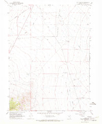
1967 Map of Cobre SE
USGS Topo · Published 1971About this map
The Toano Range dominates this portion of the Nevada high desert, illustrating a landscape defined by isolated mineral exploration and the vital passage of the Southern Pacific railroad. Mapping conducted in 1966 reveals a network of high-altitude extraction points, including several Mines and a specifically marked Prospect tucked into the steep ridgelines. These small-scale operations were linked to the lower basins primarily by a network of Jeep Trails, showing how 20th-century prospectors navigated this arid environment. The presence of the railroad line in the northwest corner of the sheet highlights the historical importance of this corridor as a transcontinental link, even as the surrounding terrain remained largely undeveloped and focused on resource extraction.
Find a feature on this map
6 named features on this map. Tap any name to fly to it.
Don’t see what you’re looking for? This feature index may not catch every label — zoom into the map to look around manually.
Map Details
Editions of this 1967 Cobre SE Map
This is the sole edition of this map. No revisions or reprints were ever made.
Other maps of this area

1955 · Wells
USGS Topo · 1:250,000

1955 · Elko
USGS Topo · 1:250,000

1958 · Wells
USGS Topo · 1:250,000

1958 · Elko
USGS Topo · 1:250,000

1961 · Wells
USGS Topo · 1:250,000

1962 · Elko
USGS Topo · 1:250,000

1965 · Elko
USGS Topo · 1:250,000

1967 · Valley Pass
USGS Topo · 1:24,000

1967 · Loray
USGS Topo · 1:24,000
1967 · Pilot Peak NW
USGS Topo · 1:24,000