
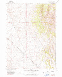
1967 Map of Valley Pass
USGS Topo · Published 1971About this map
Toano (Site) stands as a poignant marker of the railroad era within the high desert landscape of Elko County. In this late 1960s survey, the settlement is identified as a historic location situated near the Southern Pacific tracks, accompanied by a small Cem and a Water Tank that speak to its former role as a rail siding and watering stop. The infrastructure follows the natural corridor of the Goshute Valley, where the steel rails transition through the Valley Pass. To the east, the topography is dominated by the steep slopes of Murdock Mountain, while the western terrain is etched by the seasonal drainage of Toano Draw. A network of Jeep Trails provides the only modern access across this arid basin, tracing paths between the mountain foothills and the railroad right-of-way.
Find a feature on this map
9 named features on this map. Tap any name to fly to it.
Don’t see what you’re looking for? This feature index may not catch every label — zoom into the map to look around manually.
Map Details
Editions of this 1967 Valley Pass Map
2 editions found
Other maps of this area

1955 · Wells
USGS Topo · 1:250,000

1958 · Wells
USGS Topo · 1:250,000

1961 · Wells
USGS Topo · 1:250,000

1967 · Loray
USGS Topo · 1:24,000

1967 · Montello Canyon
USGS Topo · 1:24,000

1967 · Ninemile Mtn SW
USGS Topo · 1:24,000

1967 · Cobre SE
USGS Topo · 1:24,000

1967 · Cobre
USGS Topo · 1:24,000

1968 · Pequop
USGS Topo · 1:24,000
1968 · Pequop Summit
USGS Topo · 1:24,000