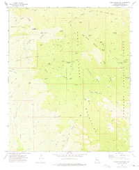
1972 Map of Cobre Grande Mtn
USGS Topo · Published 1975About this map
Santa Teresa Mountains dominate this 1970s landscape, where a history of prospecting is etched into the steep canyons and ridges. Mining activity is widespread, evidenced by operations like the Princess Pat Mine to the north and the Grand Reef Mine near Laurel Canyon. The rugged geography within the Coronado National Forest is defined by names like Horse Mountain and Imperial Mtn, connected by a network of Pack Trails and Jeep Trails that suggest a remote, working landscape. Isolated outposts such as Landsman Camp and various ruins near Tule Spring point to the transitory nature of habitation in these high-altitude terrains. Essential water sources, including Soda Water Spring and Copper Canyon Spring, are vital landmarks in an area carved by Aravaipa Gulch and Williamson Canyon.
Find a feature on this map
53 named features on this map. Tap any name to fly to it.
Don’t see what you’re looking for? This feature index may not catch every label — zoom into the map to look around manually.
Map Details
Editions of this 1972 Cobre Grande Mtn Map
This is the sole edition of this map. No revisions or reprints were ever made.
Other maps of this area

1938 · Klondyke
USGS Topo · 1:48,000

1943 · Klondyke
USGS Topo · 1:62,500

1944 · Jackson Mtn.
USGS Topo · 1:62,500

1946 · Jackson Mtn.
USGS Topo · 1:62,500

1954 · Mesa
USGS Topo · 1:250,000

1956 · Tucson
USGS Topo · 1:250,000

1957 · Mesa
USGS Topo · 1:250,000

1958 · Mesa
USGS Topo · 1:250,000

1958 · Tucson
USGS Topo · 1:250,000

1959 · Tucson
USGS Topo · 1:250,000